Tag Archives: Idaho

A Layover Day at the Challis Hot Springs Campground, Challis, ID

Homeward Bound Day 11: Saturday, April 27, 2019

When I pulled in to the campground yesterday afternoon I was surprised way beyond my expectations. I had been expecting this campground would be a few RV sites with minimal hookups located at a semi-industrial area with big metal cargo containers, dumpsters and other heavy duty equipment. But that was weeks ago when making my reservation.

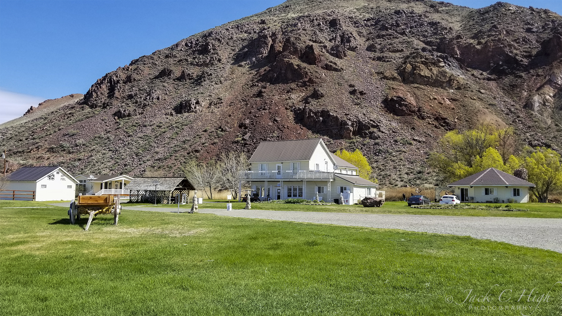
Wow! What a contrast between the real thing and my imagination. The campground is located on a country road a few miles out of town. The main building and registration office is nestled against a high bluff along with a couple of auxiliary buildings, one of which is for family gatherings and events such as weddings. Other buildings include a bath house and the hot springs pools plus what appears to be a vintage cabin of the early 1800s. A few ancient farm tools also are scattered about.

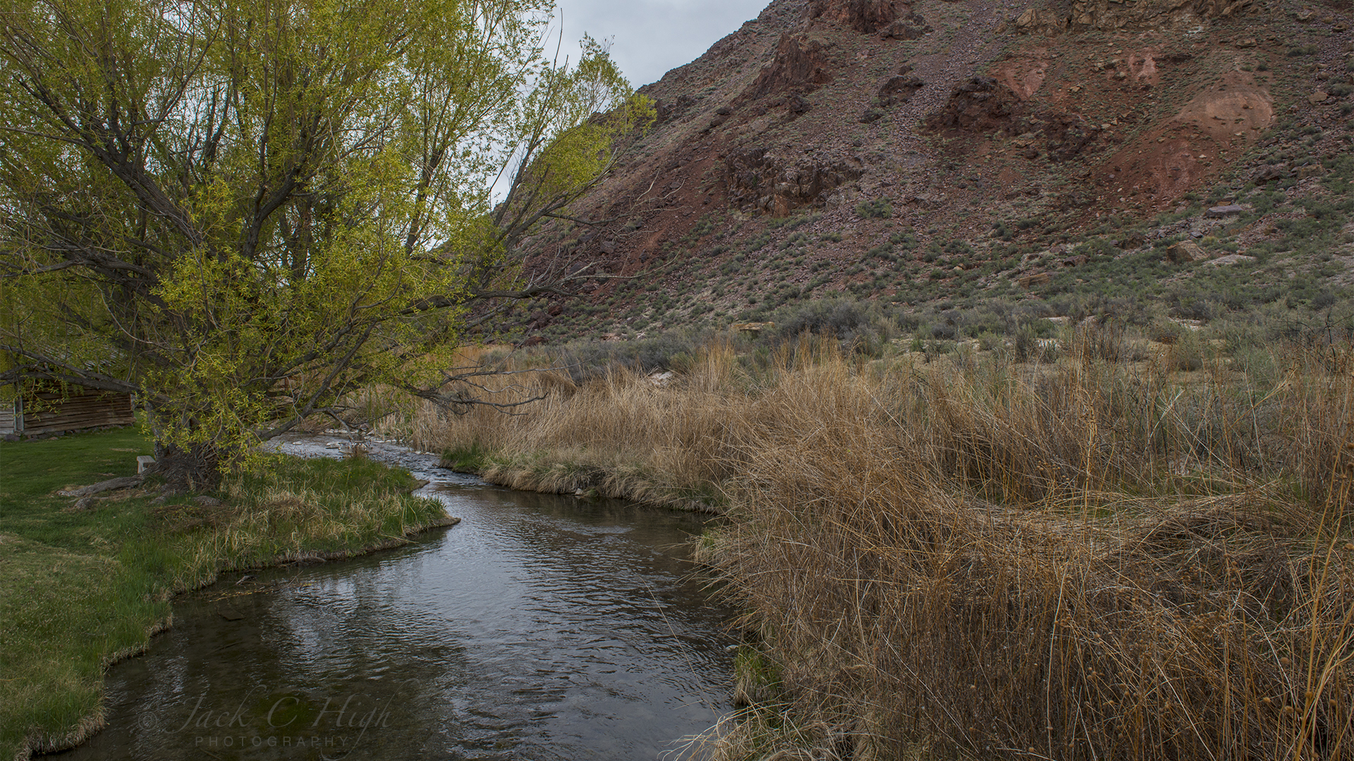
Behind the old cabin was a pretty little stream running clear and pure between the bluff and the office building. So I took a bit of time taking what I hoped would be a nice photo of the scene.
RV sites are located down by the Salmon River.
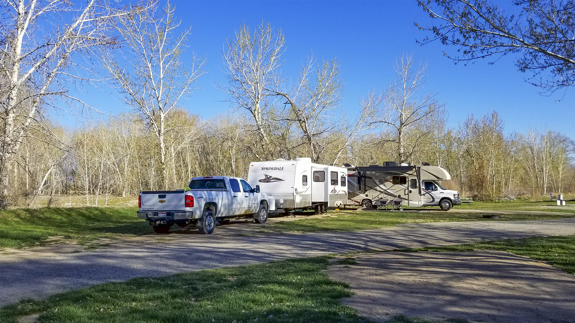
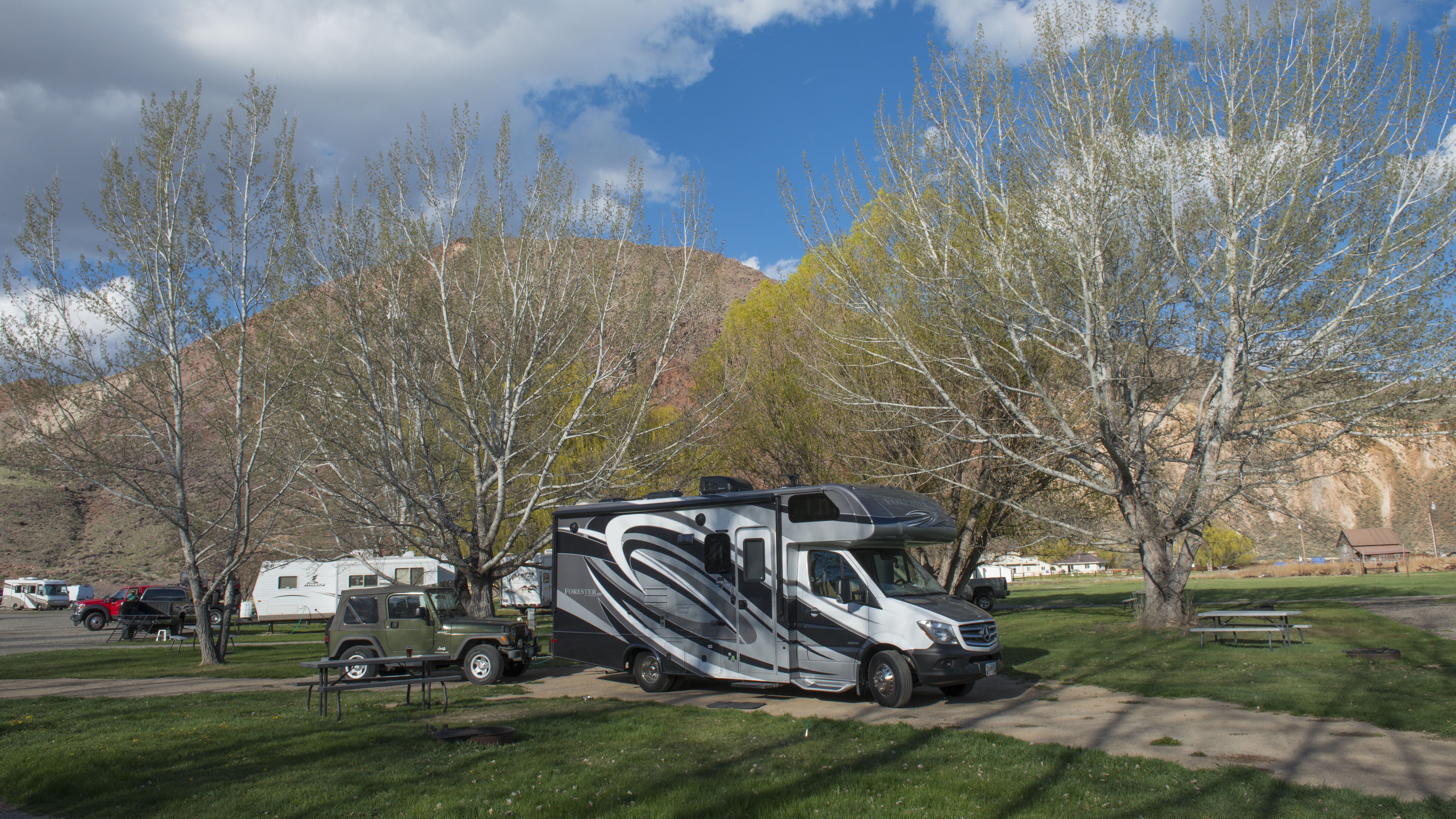
The RV sites are down by the Salmon River nestled under the trees and each site provides, water, electricity, picnic tables and fire pits. There is plenty of room between sites and the grass covered grounds invite various kinds of games for children young and old.

Set Up My RV Down by the River

My site was a pull through located just across the dirt road from the river and I enjoyed all the privacy one might want. Annie, too, liked the fresh green grass.
RV and Jeep all hooked up at Challis Hot Springs Campground.
I was so taken by the campground that shortly after hooking up my RV I walked back up to the office and registered for a second night as I decided that today would be a layover day of relaxing and a little computer time for email and Facebook and to edit photos. After a walk to take more photos of the campground, Annie and I decided to take an afternoon nap.

I was exhausted from my travels and felt that a nap in this beautiful spot was very much needed. After 30 minutes or so, I woke to discover water all over the RV floor. Temporarily confused by the unexpected sight, I then saw that water was poring from the tap into the sink and flowing over onto the floor. The water had been running the entire time I was napping. How? I don’t know. Can’t believe I forgot to turn it off but I must have forgotten. There also were puddles outside the RV on both sides.

Before I could do anything, I had to get rid of the water. But my holding tanks were full and that’s why the water was overflowing onto my floor. Unfortunately, there are no dump facilities at the RV sites so I had to figure out another way to get rid of the water. My first thought was to bail out the sink with a bucket. I gave it a try and then realized I had to drive my rig back toward the office where the park sewer dump was located. So I unhooked from the electrical box and water supply and drove back to the dump location and emptied my tanks. Then back to my site and hook up again to begin the cleanup.

Water had gotten into my cabinets under the sink and I had to empty them and dry them out. That meant putting all the contents on the small floor and tiptoeing around them as I cleaned up the mess.

Water also had run over to the opposite side of the coach interior and down into storage compartments below. So I had to empty those storage compartments as well, survey any damage and dry them out. Water also had gotten into the compartment where my coach batteries are stored so I had to soak up that water and air out the compartment. Then, I discover the electrical outlets over my sink and stove were not working. Those outlets are powered by shore power are the ones I use for making coffee and lattes.

I opened the electrical panel and flipped all the circuit breakers hoping that would solve the problem. Not so! Then I thought the outage might have been caused by a blown fuse. Great! Now I have to learn all about fuses and my electrical panel. What fuse goes to what circuit? Also the outside temperature was beginning to drop and I needed to run my two space heaters since I’m running low on propane. After cleaning everything up and stashing cooking gear and so forth back into drawers and cabinets I turned on the computer to do a little work. But that tripped the circuits and I had no heat while using the computer.

Fortunately, my brain kicked into high gear and I tried one more thing: that was to check the GFI button (Ground Fault Circuit Interrupter device) on the bathroom outlet, assuming it is on the same circuit as the kitchen outlets. I did, and it was. I reset the GFI and restored power to the outlets. Yeah! I breathed a big sigh of relief that I had not damaged the electrical circuits.
The Salmon River at Challis Hot Springs Campground.
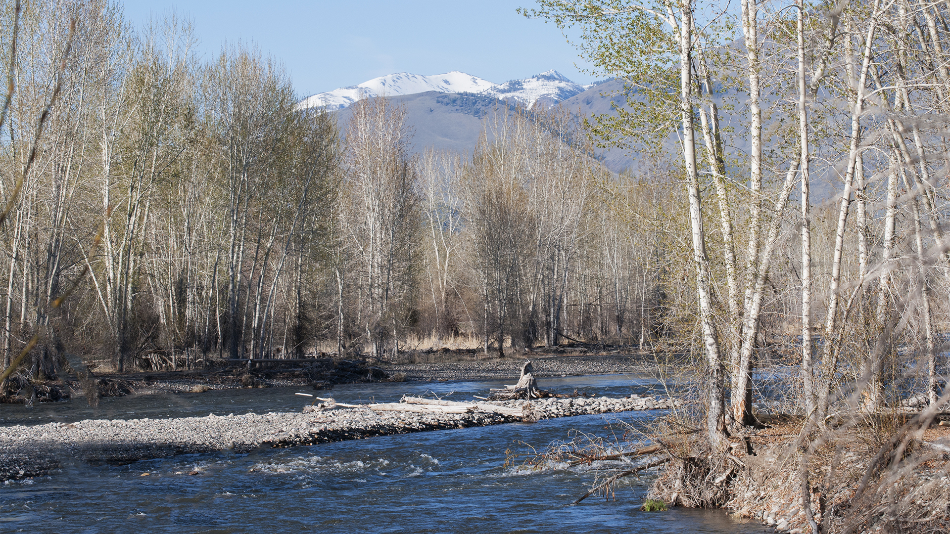
By then it was time for dinner, a walk by the river, more photography, a bit of reading and off to bed for a good night’s sleep.

3/1 to Yuma: Day Two

Snow-covered Landscape

Snow-covered landscape as viewed from Pendleton KOA Journey at Pendleton, Oregon.


The first thing this morning was letting Annie out to do her business and I saw that the view was the same as last night, i.e. a bleak, cold white in which the horizon blended with the sky Naturally, as I’m prone to do, I took a photo. I also took a photo of my rig and the park.
Jack's RV

Then, back in the RV while getting ready for the day, I decided to call a local RV dealer to arrange an appointment for repairs. Oops! It’s Saturday and no one at work in the service department. A fellow in the parts department suggested I stop by and buy a new cover, assuming he had one in stock. But he wanted a photo of the damaged cover to see if he had a replacement in stock. What? Now I have to crawl on top of the rig to take photos. I did.

Just as I was about to climb upon the roof, the fellow parked next to me came out to ready his rig for leaving. I asked, “Would you mind standing by for a moment. I need to climb up on my rig to fix a problem. In case I fall, please call 911.” He obliged.

I took photos and then taped the cracks and decided I would drive that way and do the repair in Yuma. Oh, and then I went forward on the roof and tossed down the pine bough that also had fallen on the roof.

A 53-mile section of today’s drive along I-84 was the most critical section of my 1300-mile drive to Yuma. I planned my entire six-day trip from beginning to end around the 10-day weather forecast for this one-hour drive of the trip. I wanted to make sure the highway would be bare and dry to reduce any chance of an accident caused by snow and ice.

The section is the drive from Pendleton, OR over the Blue Mountains of Northeast Oregon to La Grande, OR. From an elevation of 1,200 feet at Pendleton, the highway climbs to Deadman Pass (also known as Cabbage Hill or Emigrant Hill) at an elevation of 3,631 feet and then steeply descends 2,000 feet of double–hairpin turns to La Grande and beyond.

I finally pulled out at 11:18 after having been considerably delayed due to handling the cracked vent cover. I now was well on my way.

Back on the highway I’m looking at a lot of whiteness and I’m about to climb more than 2,000 feet into that white nothingness.

I soon saw a road sign warning “Visibility less than 500 feet.” Great! A heavy, dense fog blended into the stark white landscape.

Visibility less than 500 feet
Occasionally, I could make out the dark form of a semi in the right hand lane. I started following it, and then passed it. If I stay in the right hand lane and just keep far enough in front of the semi, that truck will prevent me from being rear ended. On the other hand, staring into the white nothingness causes the eyes, the imagination and maybe the mind to play tricks making one think there is an object up ahead when there is none. My remedy was to continually shift my vision to the right, left, up, down, or anywhere to keep from seeing something that is not there.

Sunny day in the Blue Mountains
Finally I broke out of the fog and instantly was in blazing sunshine. The time between the foggy photo and the sunny photo was only three minutes. And what a view it was!

Sign noting Deadman Pass Rest Stop.
My next challenge was crossing Deadman Pass and navigating the steep decent of double hairpin turns to where the highway almost flattens out. Sometimes the ups and downs were a challenge as I tried to maintain a reasonable and safe speed while moving in and out among big rig semi’s who roared down the steep grades at maximum speed.

From La Grande, the drive was very pleasant and enjoyable all the way to Twin Falls, Idaho.
Lane directions for Twin Falls, Idaho

Trip Data
Departure Date: 3/2/19
Depart Location: Pendleton, OR
Arrive Location: Twin Falls, ID
Time of Departure: 11:18 Hours
Time of Arrival: 18:32 Hours
Vehicle Odometer Start: 20,565
Vehicle Odometer End: 20,920
Trip Odometer: 355
Moving Time: Hours = 05:56
Stopped Time: Hours = 0:1:19
Maximum Speed: 77.5 mph
Moving Average: 59.7mph
Overall Average: 48.8 mph
Elevation: 3,809
Odometer: 354.86
Total Ascent: 12,466 feet
Maximum Elevation: 4,308 feet
Latitude: N 42, 33.269
Longitude: W 114, 34.380

Nugget RV Park In St. Regis, Montana to Liberty Lake, Washington to Service RV

The Nugget RV Park in St. Regis, MT.

The Nugget RV Park in St. Regis, MT is my all time favorite RV park.

The Nugget RV Park in St. Regis, MT is my all time favorite RV park. I spent 50 nights at The Nugget in 2018 and 48 in 2017. The park is owned by a wonderful couple, Mark and Leslie Leenhouts, and they make their guests feel as if they are part of the family. I have made many RV friends there from all over the US and Canada and many of us still stay in touch.

It’s always hard to say “Good By” when leaving the Nugget RV Park but when you got to go you got to go. Even when the temperature is only 12 degrees when you pull out in the morning. Yesterday was a layover day and now it’s time to be on the road again.

Leaving the Nugget and the town of St. Regis, MT I soon was on I-90 in the west bound lane heading for Liberty Lake, WA. This section of I-90 is a beautiful drive. The highway follows alongside the Clark Fork River from Missoula to St. Regis. Past St. Regis, the highway follows the St. Regis River up to Lookout Pass.

Crossing Lookout Pass from the Nugget RV Park and Into Idaho

Lookout Pass on I-90

Lookout Pass is on the border of Idaho and Montana at an elevation of 4,710 feet and also is the border of two time zones, the Pacific Time Zone and the Mountain Time Zone.

Lookout Pass, at an elevation of 4,710 feet (1,436 m) marks the border between Montana and Idaho and is “Exit 0” on Interstate 90 in Montana. The pass also hosts the Lookout Pass Ski and Recreation Area which was established in 1935. The pass also has the distinction of being a time zone border. Northern Idaho is on Pacific Time and Montana is on Mountain Time. Lucky for me, the highway here was clear and bare though snow can be seen on the surrounding slopes.

Once beyond Lookout Pass, the drive is all downhill to Wallace, Idaho and then on westward until one reaches the Fourth of July Pass. The Fourth of July Pass is about 11 miles east of Coeur d’Alene, Idaho at an elevation of 3,081 feet (939 m).

Fourth of July Pass in Northern Idaho

The Fourth of July Pass at an elevation of 3,081 feet (939 m) is about 11 miles from Coeur d’Alene, Idaho.

Passing through Coeur d’Alene I drove on into Liberty Lake and set my RV up at R’NR RV Center for servicing.

Reuniting With Friends In Spokane, Washington

Happy Hour with friends and associates.
I then dropped my little English Cocker, Annie, off to be groomed and then joined friends and business associates at Twigs Bistro and Martini Bar – South Hill for Happy Hour. Our little group had worked together for about 10 years prior to me moving to Montana. It was a great evening of sharing and then back to my RV for the night.

Trip Data

  • Departure Date: 12/5/18
  • Arrival Date: 12/5/18
  • Depart Location: St. Regis, MT
  • Arrive Location:Liberty Lake, WA
  • Time of Departure: 10:55 Hours
  • Time of Arrival: 14:06 Hours
  • Vehicle Odometer Start: 16,924
  • Vehicle Odometer End: 17,040
  • Trip Odometer: 115
  • Moving Time: Hours = 02:17
  • Stopped Time: Hours = 0:53:07
  • Maximum Speed: 71.9 mph
  • Moving Average: 50.2 mph
  • Overall Average: 36.2 mph
  • Elevation at Destination: 2,044
  • Odometer: 115.25
  • Total Ascent: 4,500 feet
  • Maximum Elevation: 4,783 feet
  • Latitude: N 47, 40.700
  • Longitude: W 117, 05.844