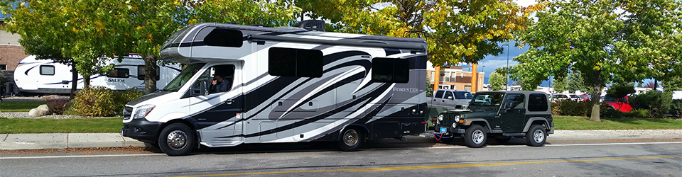
I just bought, and tried out, a new ROVE R2-4K dash cam and love it. 1) It takes really nice videos. 2) The file format is the commonly used mp4, which makes it really easy to use, watch or edit, when placed on a PC or laptop. 3) While capturing images it’s generating mp4 files at the rate of a new file every minute. In other words, during a 10 minute drive it will have generated 10 one-minute files instead of one ten=minute file. I just have to remember to not put things on the dashboard in view of the camera. Here’s a one-minute sample of a 30-minute drive.
Though the information isn’t seen here, the camera includes much information about the video in a panel below the image including date and time taken, speed of travel and the GPS coordinates.
The image below is just one frame from the video and I’ve converted it to a still shot to give me the ability to post it here.
Well . . . here it is: Sunday, December 4. Last night the temperature dropped to a single digit and tonight the forecast is for a low of 13 degrees.
I had planned to spend the winter in Yuma, AZ but I have an appointment this Thursday to have Amber, my English Springer Spaniel, spayed. That, plus my own several doctor appointments following my heart attack last November 16 means I’ll spend much, if not all, of the winter in Montana.
But I’m prepared for the cold weather.
Montana winter home.
I did not winterize my 25-foot Forest River “Forester” motor home. Instead, I’ve set up a number of procedures to keep any onboard water from freezing and breaking pipes.
My winter routine is outlined below. My only concern is whether or not the ice buildup on the exterior will create problems when the ice thaws.
I’ve set the switch on my “Arctic Pak” to “on”. The Arctic Pak is a set of heated pads surrounding each of my tanks, i.e., gray, black and freshwater tanks.
My furnace is powered by propane and I set the temperature at 55 degrees.
I’ve turned off my onboard propane tank and rigged an external 20-pound propane tank to power the furnace. I actually have 3 external propane tanks. When a tank is near empty, I then swap it out with a full tank.
Additionally, I have a small space heather on the floor that runs continuously.
An indoor/outdoor thermometer is set on the floor under my dining table. The outdoor thermometer hangs from my passenger side rear view mirror. Last night the temperature on the floor was 45 degrees and the outdoor temp was 17 degrees.
A small (about one square inch) magnetized thermometer also is stuck to my range hood. That thermometer let’s me know the temperature at about shoulder height.
I also keep all cabinet and closet doors open as well as the door to the bathroom.
That pretty well describes and sums up how I keep my RV from freezing in the winter.
I have a 25-foot motor home on a Mercedes-Benz “Sprinter” chassis. The mileage on my six-year-old RV is 40,838. My RV manual says at that number of miles my RV is due for a “Type A” service.
Previously I had always gone to the Mercedes-Benz Dealer in Liberty Lake, WA. But this time I chose the Missoula dealer because I would drive significantly fewer miles and thereby save time. The drive to the dealer in Liberty Lake, WA is 240 miles and takes a little over four hours to get there. Whereas the drive to Demarois Buick GMC Mercedes-Benz in Missoula, Montana is only 119 miles and the estimated drive time is 2 hours and 13 minutes.. So, I chose Missoula. Big mistake.
The service advisors (two of them) quoted $500 to $700 for the Type A Service, which is about the same as the figures given me by the Liberty Lake dealer. However, Nate, the service advisor kept upselling me saying Mercedes also recommends “this and that”. My bill ended up being more than $2,000. Yes, I fell for being “upsold” and I paid a heavy price for it.
Below is an important read for anyone having a vehicle serviced. Read it and hopefully avoid my very expensive mistake. The piece explains how vehicle dealers and even repair shops practice a system of “upselling” that can cost you thousands of dollars..
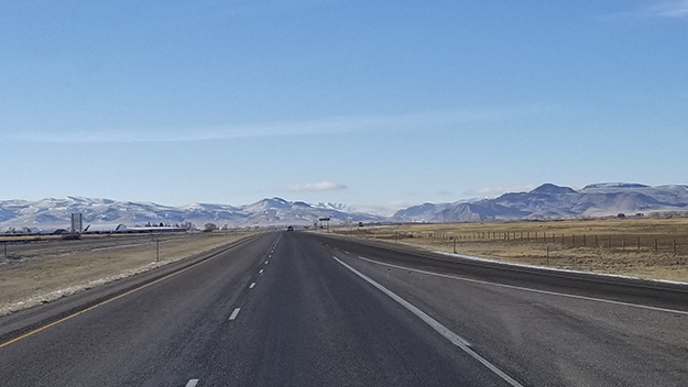
Alamo, Nevada is my destination for the day and today’s drive is longer than yesterday’s. I’ll be driving about 395 miles and should arrive in Alamo in six hours or less.
Alamo is a small unincorporated town in southeast Nevada at an elevation of 3,449 feet located about 90 miles north of Las Vegas on US 93. The population is only about 1,080 people and the town’s economy is dependent primarily upon ranching. The town also caters to tourists and snowbirders traveling up and down the popular highway in cars, 18 wheeler trucks and RVs. Two service stations with large diesel filling areas serve truckers and RVers. There also is an RV park, Picketts RV Park, and four motels to accommodate travelers.
No snow nor snow showers are in the forecast for the next ten days. Also, I am far enough south that I’ll be enjoying warmer weather and dry pavement the farther south I drive.
This is a familiar drive. I have driven the route in both directions several times. In fact, this is my fourth winter to be a Snowbird. My first snowbird winter I went to Lake Havasu City, Arizona. This winter will be my third to spend in Yuma, Arizona.
I’m up early this morning and I can quickly take care of my chores and be on the road. Before leaving the park, I stop by the office to fill my onboard propane tank since I’ve been using my furnace on these cold nights. No luck. The staff has not been able to find the connection for attaching their propane supply to my tank. I’ll buy propane further down the road and most likely at Picketts RV Park, my stop for the night in Alamo.
I exit the park and head south on US 93. This highway is a perfect drive as it stretches north to south from Montana to Arizona.
A Tragic Accident
Tragic auto accident south of Twin Falls, Idaho on US 93.
I had driven only about 20 miles when I came upon several emergency response vehicles and responders at the scene of a two-car accident. I later learned there had been at least one fatality.
Fortunately, my 10-day weather forecast of bare and dry pavement all the way to Alamo is holding true. The weather is looking good and I am enjoying blue sky with broken clouds. At about 10:00 AM I encounter one of those overpasses that allow wildlife to cross over the highway. A few miles further I cross under another one. And before long, I cross the border into Nevada and pass through the town of Jackpot.
Jackpot, Nevada is an unincorporated community at an elevation of 5,213 feet with a population of 1,195 as of the 2010 census. The town was founded in the early 1950’s when Idaho started cracking down on gambling laws and is host to several casinos and casino hotels. I suspect the town is financially supported by many visitors from Idaho.
Soon after 10:00 AM I’m approaching Wells, Nevada. Wells, at an elevation of 5,630 feet, is another small town. The population is almost 3,000. It’s time to fill up with diesel fuel. I buy 11.947 gallons of diesel at $2.959 per gallon for a total of $35.35. I had driven 117 miles since filling up yesterday in Twin Falls, Idaho. My mileage since that fill up was only 9.8 miles to the gallon. The low mileage, no doubt, is due to an elevation gain of almost 2,000 feet since leaving Twin Falls.
Ely, Nevada
Ely, Nevada is my next stop for fuel. The town was founded as a stagecoach station along the Pony Express and Central Overland Route. So, there is a lot of history here. At an elevation of 6,035, Ely is a bit larger than Wells. The town has a population of 4,035 as of 2019. The town has several RV parks including the Ely KOA and a campground. Other lodging includes several hotels and motels and a bed and breakfast. Dining opportunities include restaurants and eateries like the Cell Block Steakhouse, All Aboard Inn, a couple of Taco shops, and a McDonalds among others.
Approaching Ely, I see some old relics that catch my eye. One is “The Old Victory Club”, a dilapidated building that likely will collapse one of these winters. The other relic is a fairly large collection of very old and rusty automobiles of a bygone era. I bet there is a market for those old rusted hulks. Any one of them might be worthy of a “build”.
Abandoned cars and trucks of a bygone era.
Once in Ely, I fill up with diesel fuel again. I buy 13.771 gallons at 2.799 per gallon for a total of $38.55. I had driven 136 miles since filling up in Wells and gotten only 9.9 miles to the gallon. Is it the altitude that’s causing my mpg to drop? Not sure.
After refueling, I navigate through town to find my preferred route to Alamo. I have two choices. One is the US 50 and US 93 route. US 50 and US 93 converge in Ely. US 93 and US 50 then head southeast on the same roadbed for about 20 miles. US 50 soon splits off and heads east while US 93 continues south through the Great Basin National Park. This route is designated as the “The Great Basin Highway” and is the longer of the two routes. The other route is state routes 6 and 318, which is shorter and more direct. Both go through the Great Basin.
The Great Basin and Great Basin National Park
The Great Basin National Park is a relatively small area within the greater “Great “hydrographic” Basin”. The hydrographic basin is an extensive expanse of desert valleys and mountains covering most of Nevada, much of Utah and Oregon and portions of Idaho, Wyoming, California, and even Baja California in Mexico.
The basin is called a “hydrographic” basin because all rainwater falling into the area either evaporates, sinks into the ground or flows into lakes. No water flows out of the basin.
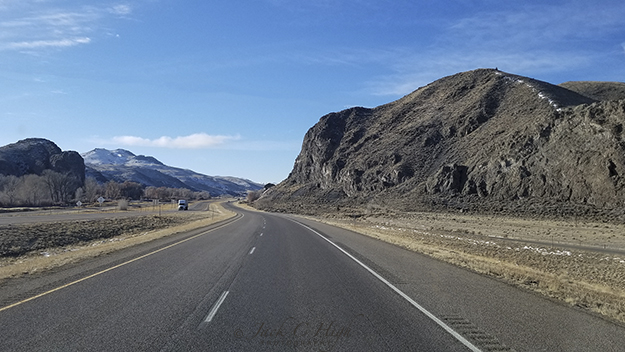
By the time I entered Nevada, I already was in the “Great Basin”. And now in Ely, I need to choose which of the two routes to take toward Alamo. Both will get me there. The two routes parallel each other on the east side of the state and are separated by the Egan Mountain Range.
I’ve driven both routes at different times and my preference is state routes 6 and 318. Now I must remember which direction to choose at each of two T-shaped intersections. And for some reason I’m confused on this trip so I have to take a few moments at each intersection to think through my decision. I don’t find the signage to be particularly helpful. But I make a decision and soon I am on state route 6 and approaching Murry Summit, which is a short drive from Ely.
Murry Summit
Murry Summit, elevation 7,316 is a gap in the Egan Range. The range is a line of mountains 108 miles in length. On one of my first trips over Murry Summit I encountered snow for the first time in my RV. That was a bit unnerving. However, today the highway is bare and dry with a light coating of snow on the highway shoulders and among the trees.
Murry Summit at an elevation of 7,316 feet is a gap in the 108 mile long Egan Mountain Range.
But before reaching the summit, I decide to pass a slow-moving big 5th wheel. I had been following it for a while and I was becoming impatient. Passing the rig was a bad decision. I broke my cardinal rule of not passing another vehicle when I’m driving uphill. Soon after passing the big 5th wheel I see I’m fast approaching my SR 318 exit. I immediately start braking to make the turn knowing the big 5th wheel is close behind me. I bet the driver of that RV was cursing me big time. After making the turn on SR 318, I step on the gas with that 5th wheel right on my tail. I speed ahead and then it’s down the mountains and into the White River Valley as fast as I could go
SR 318 Is The Preferred Highway to Alamo
SR 318 is a 122-mile stretch of highway from the junction of state route 6 and 318. So there is plenty of time to contemplate life and enjoy the scenery. The highway is preferred by many snowbirds and RVers. One probably sees more recreational vehicles on this stretch than any other type of vehicle.
An interesting side note about Nevada topography is that mountains and valleys are oriented north and south. If you were to cross the state east to west you would pass through a valley, over a mountain range into another valley and over another mountain range and into another valley. This topography is known as “basin and range” topography. You can learn more about the concept of basin and range by reading John McPhee’s Basin and Range, a paperback.
Highway 318 south of Ely, Nevada runs pretty much in a straight line for many miles.
The road ahead is mostly clear of traffic and it is a long straight drive for many miles. I reflect on my bad decision to pass the 5th wheel when I did and try to settle down and enjoy the ride. The scenery is an empty highway in front of me and desert mountain ranges to the left and right.
Arriving at Alamo, Nevada for the night
Arriving at the little village of Alamo, Nevada I pull into the big Sinclair service station and fill up with diesel fuel. I buy 12.697 gallons of fuel at 2.599 per gallon for a total of $33.00. I had driven 147 miles since filling up in Ely and gotten 11.6 miles to the gallon. Driving fast had cost me.
I arrive at Alamo, Nevada shortly after 4:00 PM after driving 395 miles from Twin Falls, Idaho.
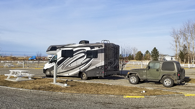
After filling up with diesel fuel, I check in at the Pickett RV Park. I’m greeted by the owners, and I have my onboard propane tank filled. Then I pull into site #2, the same site I’ve stayed in on previous trips. After setting up for the night I walk over to the Sinclair station and buy a hamburger with fries that I take back to my RV and eat my dinner.
I then transfer photos from my smartphone to my PC, edit a few photographs and post them to Facebook. I also download the track of today’s drive from my handheld Garmin GPSMAP 60 (It’s now 15 years old) to my desktop machine. Then, it’s time for bed.
I had driven some 395 miles from Twin Falls, Idaho to Alamo, Nevada. My “drive time” was six hours and 28 minutes.
Twin Falls, Idaho Is my next stop and I’m both reluctant and also eager to be on the road. Happily, the weather is holding and I awoke to sunny skies with no hint of snow.
The first thing I did this morning was to check the weather forecast. The forecast still called for less than 1-inch of snow in Idaho Falls, Pocatello, and Twin Falls. No change for the next three days.
Last night was cold and I used my furnace as well as my space heaters to keep my coach warm. I slept well enough and woke at a decent hour. My first thought was to fill my onboard propane tank.
After a quick breakfast, I unhooked my electrical line and stowed it. Last night I didn’t bother with hooking up to city water or even to the sewer system. So there wasn’t much to do to prepare for the day’s drive to Twin Falls, Idaho other than stowing stuff in the coach so as not to break anything.
I’m reluctant to leave Dillon because the area is rich with early American history. Much of that history has to do with the Lewis and Clark Expedition. After their journey up the Jefferson and Beaverhead Rivers, members of the expedition arrived in the greater Dillon area early in August 1805. A notable landmark, for example, is Beaverhead Rock, now a state park. The rock is located about 12 miles southwest of the town of Twin Bridges on Montana Highway 41 and about 14 miles northeast of Dillon. When Sacajawea saw the rock she knew she was near the area where her Shoshone tribe spent its summers.
Twin Falls is 286 miles Ahead
As much as I would like to spend a few days here exploring the area, it’s time to move on. Today’s drive to Twin Falls, Idaho is a distance of 286 miles which should take four hours and 36 minutes according to Google Maps.
In Need of Propane
I walked over to the office and checked out. I also asked for propane, which the park didn’t have. But I did fill my fresh water tank. Soon, I was driving out of the park and heading for a service station.
10:05 AM: The first service station I found was a CENEX located at 700 North Montana St. Phone: 406-683-2308. The station is operated by Rocky Mountain Supply, which also has stores in Belgrade, Townsend and Ennis, Montana. The stores are like big mercantile or ranch and farm stores. Each store offers a full line of energy products such as gasoline, diesel fuel, and lubricants as well as a full line of crop nutrient and crop protection products, seed, field application of crop nutrients. The stores also sell hardware, livestock equipment, animal health products, feed supplements, pet supplies, western wear clothing and boots, sporting goods, convenience store items and other products and services too numerous to mention.
New Year’s Day Not Good for Traveling
I wanted propane, but the office was closed as it was New Year’s Day and no one was on hand to service customers. So there was no propane. But I did fill up with diesel fuel. I bought 12.203 gallons at $2.499 per gallon for a total of $30.50. I had driven 124 miles since filling up the night before in Drummond, Montana and my mileage was only 10.2 miles per gallon on that tank.
The Area is Rich in Lewis and Clark History
Having refueled my motor home, it was time to be on the road again toward Twin Falls, Idaho. At the same time I’m aware that I’m in an area that is rich with Lewis and Clark landmarks and history. I will be passing several of these landmarks today.
View of the gap in the mountains spotted by Clark from a distance of about 7 miles. That “gap” is the Beaverhead Canyon Gateway.
One of these landmarks is the Beaverhead Canyon Gateway. This gap in the mountains was spotted by Clark from a spot known as “Clark’s Lookout”, or, “Surveyor’s Station.” The “Gateway” was yet another 10 miles in front of him and his party. The “Gateway” canyon reportedly averages 600 feet in depth and extends seven river miles south to another unnamed portal formed by Pipeorgan Rock. I don’t have time to visit these historic landmarks today. But I will be back another time to leisurely explore them.
The Beaverhead Canyon Gateway is a gap in the mountains at an elevation of 5236 feet. Clark mistakenly believed this would be the last gap in the mountains the expedition would have to cross. Yet to come was the crossing of the Bitterroot in Idaho.
These rocks on the right likely are the Rattle Snake Cliffs cited by Lewis on August 10, 1805 in his journal for that date. This is about the point that Lewis with Drewyer and Shields left the Beaverhead River and hiked up Horse Prairie Creek toward what we know today as Lemhi Pass. Clark and the rest of the expedition were pulling their canoes up the Beaverhead River about five days behind Lewis.
Once through the gap it’s just a short distance to The Clark Canyon Reservoir and Recreation Area off to the right. On this day, the reservoir was solidly frozen over and there were quite a few fishing shanties on the ice. They were occupied by virtue of the large number of vehicles parked along the shore. The Clark Canyon Reservoir now covers the land and streams where Lewis set out to explore Horse Prairie Creek, the major tributary flowing into the Beaverhead River. Horse Prairie Creek descends from Lemhi Pass where the Lewis and Clark Expedition first encountered the Shoshone tribe and Sacagawea’s relatives.
On To Twin Falls, Idaho
Monida Pass is at the border of Montana and Idaho. The name of the pass takes the first three letters of “Montana and the first three letters of “Idaho” and thus is Monida Pass.
Beyond Clark Canon Reservoir, I-15 continues south and it’s a fairly short distance to Monida Pass at an elevation of 6,870 feet, 2,094 meters. As I cross the pass shortly after the noon hour, my dashboard display is showing an outside temperature of 19 degrees. The sky is overcast and snow lies either side of I-15, but the highway is clear. Monida Pass is at the border of Montana and Idaho. The name of the pass takes the first three letters of “Montana” and the first three letters of “Idaho” and thus is Monida Pass.
By the time I reach Exit 72 and follow I-86 West toward Twin Falls, Idaho, there is no more snow and the highway continues to be bare and dry. I exit off I-86 and cross the Snake River into Twin Falls around 3:00 PM and stop at a service station to fill up with diesel fuel. I pull into a Maverik station at 883 Blue Lakes Boulevard. There I buy 14742 gallons of diesel at $2.639 per gallon for a total of $48.90. I had driven 163 miles since my prior fill up in Idaho Falls, ID and gotten 11.1 miles per gallon on that tank.
After filling up I continue on to the Twin Falls 93 RV Park at 2404 E. 3830 N, Filer, ID 83328. Phone: 208-326-5092. The park is located on US 93 a half mile south of the Highway 30/Highway 93 Junction in Twin Falls. I check in and hook up for the night.
Hooked up for the night at the Twin Falls 93 RV Park. I eat my evening meal and it’s off to bed for the night.
Dillon, Montana is my destination for today’s drive. Google Maps states the drive of 286 miles to Dillon should take 4 hours and 38 minutes. My biggest concern for the drive is the possibility of snow-covered highways. With luck, the highways will be clear of ice and snow. My reservation for the night is at The Beaverhead RV and Campground, one of several RV parks in Dillon. The majority of RV parks in Montana close for the winter on or about September 15. But there are a few like this one that stay open all year.
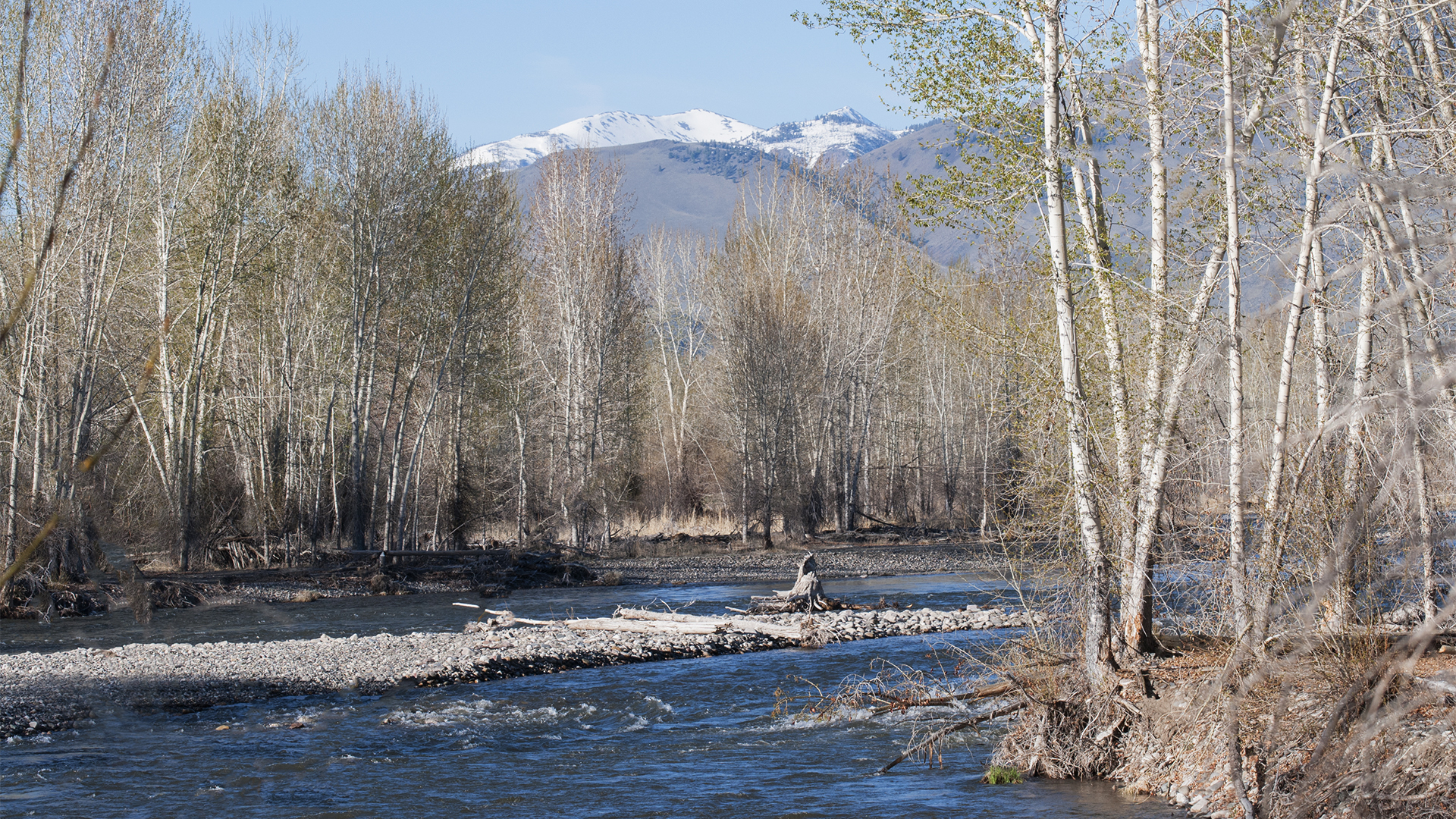
Four inches of new snow fell last night and less than an inch is forecast for this morning.
The first thing I did upon waking up was to check the 10-day weather forecast for the main cities and towns along my route including my destination for the day. Snowed covered highways was my biggest concern. The forecast was the same as it had been for the past several days. Leaving home today there was a chance of less than 1 inch of snow. The same for passing through Missoula. The forecast for Dillon was cold, but no snow. Less than one inch of snow also was forecast for Pocatello and Twin Falls, Idaho.
After checking the forecast I went outside and took a photo of the mountain behind the house and to see how much snow fell overnight.
Though I woke up early enough, I didn’t start my journey until 1:25 PM and arrived at the Beaverhead RV and Campground in Dillon at about 8:20 PM.
Can’t explain the late departure other than there were last minute details to care for including a bit of housekeeping at home and a few more items to move to the RV.
About four inches of snow fell yesterday so I had to shovel my track to the RV to facilitate carrying gear by cart to the RV. Snow was light weight and fluffy so it was easy to shovel.
I had been loading the RV for several days. And last night I loaded the rear end of my Jeep with items too big or unwieldy for the RV. With everything loaded it is time to hook up. Hooking up the Jeep to the RV was no problem. The task was completed in short order.
My next concern was driving the gravel road to the paved highway. The gravel road was not a problem. There was a fresh four- inch layer of snow covering it. But I knew the weight of the RV would give me traction. I was not so sure about getting over the small hump to be climbed where the gravel road intersects with the paved county road. Earlier in the morning someone became stuck trying to drive over the hump and needed a tow truck to get out. Whoever towed that driver also graded snow from the hump. Thus, I had no trouble driving the 1/8th of a mile to the highway and driving up the hump to make a left turn on the paved road.
Once on the paved road I could see that it had been graded. There was only a slight cover of snow and ice over the pavement and I had no trouble reaching the highway. Happily the highway was clear of snow and ice and just bare pavement.
Highway conditions remained the same all the way to Missoula; “clear of snow and ice and just bare pavement”.
Happily, US 93 was clear of ice and snow all the way to Missoula. The pavement was bare, but I did pick up a lot of dirt on my RV and Jeep. Hopefully, the highways will be bare all the way to Dillon
While descending the Grade down US 93 to I-90, I received a telephone call from my friend and ex-neighbor in Washington State. That was about 4:00 PM. We had been neighbors for about 10 years and the two of us with a couple of other guys would take road trips to Yellowstone and later to Glacier National Park. We talked for about 30 minutes while I’m driving and it was a pleasant visit and made the drive a bit more enjoyable.
Approaching the 5:00 o’clock hour, the daylight was fast fading and it was time to stop taking photos.
4:23 PM. I take my last photo of the day as the sun has set and the light was not good enough for any more photos today. The location where that photo was taken was about seven or eight miles north of Drummond, Montana.
5:03 PM: Do I fill up now, or, take a chance I can make it to Deer Lodge? Not wanting to risk running out of fuel, I take the Drummond, Montana Exit 153 that puts me on E Front Street. I follow E Front Street to Fic’s Conoco at 418 East Front. There, I buy 17.873 gallons of diesel at $2.389 per gallon for a total of $42.70. I had driven 200 miles since my previous fill up at home and got 11.2 miles per gallon on that tank. After filling up I continue on East Front to the on ramp to I-90.
5:49 PM. I’m hungry and need food so I pull off I-90 at Deer Lodge and pull into the McDonalds located at 133 N Interchange and buy a Quarter Pounder with Cheese and a small order of fries. I take the food back to the RV and have my dinner. Then, thinking I still have a ways to drive, I go back in and get a cup of coffee to go. Then I’m on my way again.
Approaching Dillon, Montana at about 8:00 PM, I cross the Beaverhead River and exit I-15 at Exit 63. My smartphone takes me across I-15 and puts me heading northeast on Business I-15 and turn right on Swenson Way and follow it to South Bozeman Street and follow it for a couple of blocks.
Finding Beaverhead RV and Campground in the dark was a bit confusing. Needed my smart phone to get there. The magenta line is my track.
I then turn west on West Park Street and soon I’m at the entrance to the Beaverhead RV and Campground. After entering the park, I mistakenly turn to the right, a mistake that leads to even more confusion. When registering I was told to turn left. Had I followed the instructions I would have soon found my site, Site number 8. However I spent more than 20 minutes driving around in the dark totally confused as to where site 8 was located. I finally found it and set up for the night, ate supper and was soon in bed.
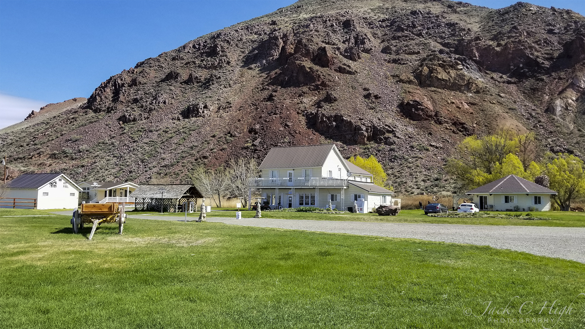
When I pulled in to the campground yesterday afternoon I was surprised way beyond my expectations. I had been expecting this campground would be a few RV sites with minimal hookups located at a semi-industrial area with big metal cargo containers, dumpsters and other heavy duty equipment. But that was weeks ago when making my reservation.
Wow! What a contrast between the real thing and my imagination. The campground is located on a country road a few miles out of town. The main building and registration office is nestled against a high bluff along with a couple of auxiliary buildings, one of which is for family gatherings and events such as weddings. Other buildings include a bath house and the hot springs pools plus what appears to be a vintage cabin of the early 1800s. A few ancient farm tools also are scattered about.
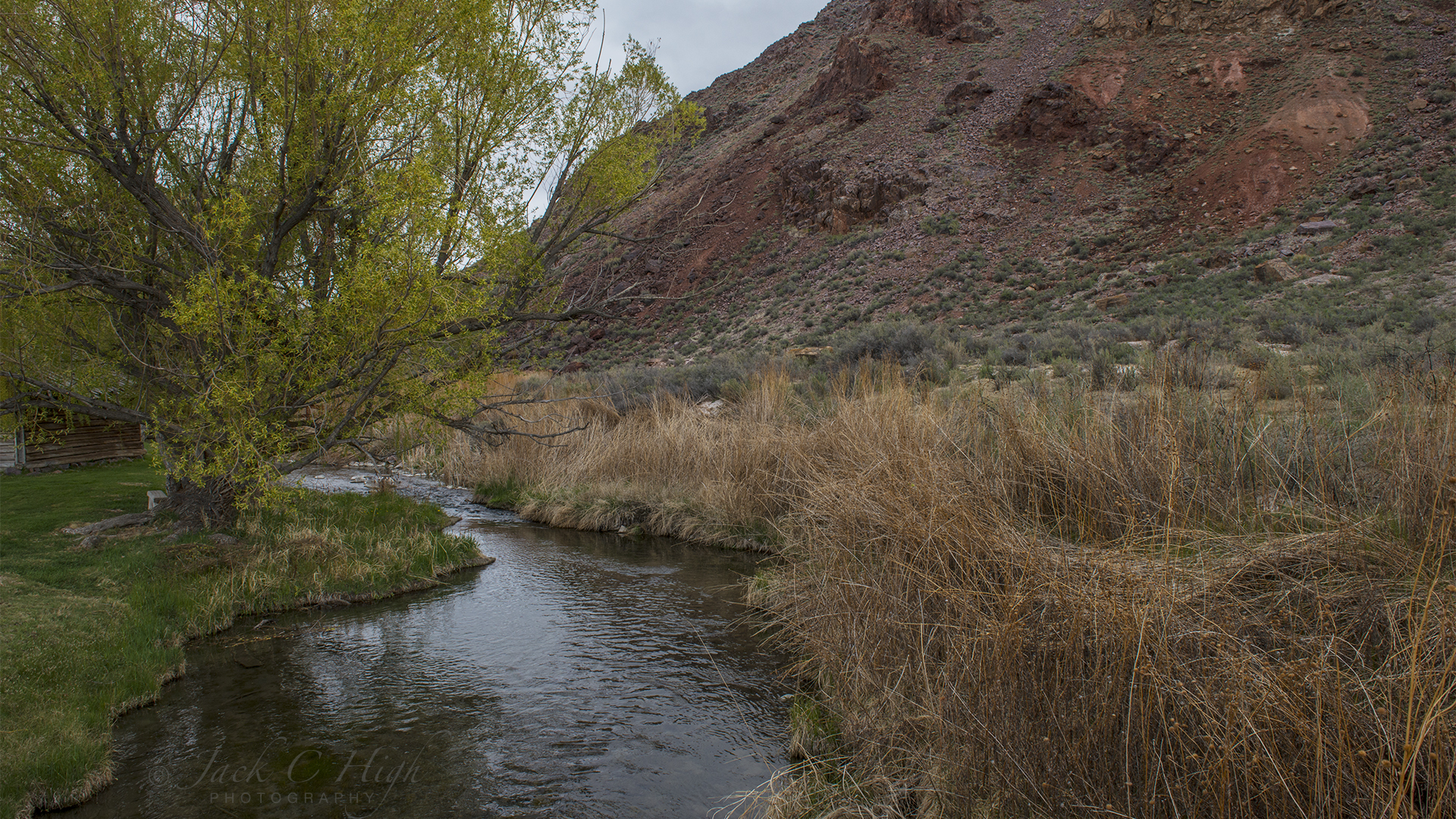
Behind the old cabin was a pretty little stream running clear and pure between the bluff and the office building. So I took a bit of time taking what I hoped would be a nice photo of the scene.
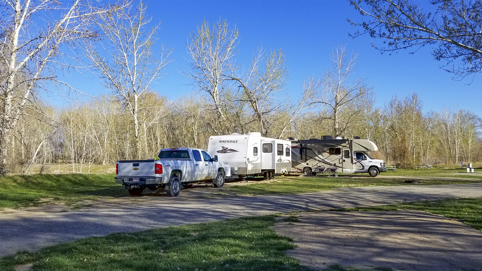
The RV sites are down by the Salmon River nestled under the trees and each site provides, water, electricity, picnic tables and fire pits. There is plenty of room between sites and the grass covered grounds invite various kinds of games for children young and old.
Set Up My RV Down by the River
My site was a pull through located just across the dirt road from the river and I enjoyed all the privacy one might want. Annie, too, liked the fresh green grass.
I was so taken by the campground that shortly after hooking up my RV I walked back up to the office and registered for a second night as I decided that today would be a layover day of relaxing and a little computer time for email and Facebook and to edit photos. After a walk to take more photos of the campground, Annie and I decided to take an afternoon nap.
I was exhausted from my travels and felt that a nap in this beautiful spot was very much needed. After 30 minutes or so, I woke to discover water all over the RV floor. Temporarily confused by the unexpected sight, I then saw that water was poring from the tap into the sink and flowing over onto the floor. The water had been running the entire time I was napping. How? I don’t know. Can’t believe I forgot to turn it off but I must have forgotten. There also were puddles outside the RV on both sides.
Before I could do anything, I had to get rid of the water. But my holding tanks were full and that’s why the water was overflowing onto my floor. Unfortunately, there are no dump facilities at the RV sites so I had to figure out another way to get rid of the water. My first thought was to bail out the sink with a bucket. I gave it a try and then realized I had to drive my rig back toward the office where the park sewer dump was located. So I unhooked from the electrical box and water supply and drove back to the dump location and emptied my tanks. Then back to my site and hook up again to begin the cleanup.
Water had gotten into my cabinets under the sink and I had to empty them and dry them out. That meant putting all the contents on the small floor and tiptoeing around them as I cleaned up the mess.
Water also had run over to the opposite side of the coach interior and down into storage compartments below. So I had to empty those storage compartments as well, survey any damage and dry them out. Water also had gotten into the compartment where my coach batteries are stored so I had to soak up that water and air out the compartment. Then, I discover the electrical outlets over my sink and stove were not working. Those outlets are powered by shore power are the ones I use for making coffee and lattes.
I opened the electrical panel and flipped all the circuit breakers hoping that would solve the problem. Not so! Then I thought the outage might have been caused by a blown fuse. Great! Now I have to learn all about fuses and my electrical panel. What fuse goes to what circuit? Also the outside temperature was beginning to drop and I needed to run my two space heaters since I’m running low on propane. After cleaning everything up and stashing cooking gear and so forth back into drawers and cabinets I turned on the computer to do a little work. But that tripped the circuits and I had no heat while using the computer.
Fortunately, my brain kicked into high gear and I tried one more thing: that was to check the GFI button (Ground Fault Circuit Interrupter device) on the bathroom outlet, assuming it is on the same circuit as the kitchen outlets. I did, and it was. I reset the GFI and restored power to the outlets. Yeah! I breathed a big sigh of relief that I had not damaged the electrical circuits.
By then it was time for dinner, a walk by the river, more photography, a bit of reading and off to bed for a good night’s sleep.
I woke to a certain amount of excitement and anticipation of today’s drive for this one is a favorite that I have driven several times. The drive is a favorite because it follows two beautiful rivers born of streams flowing from Galena Summit and the nearby mountain ranges. One is the Big Wood River, which flows south from Galena Summit; the other is the Salmon River, which flows north from Galena Summit.
Galena Summit, a mountain pass crossed by Highway 75 at an elevation of 8,701 feet (2,560 meters), is the highest highway mountain pass in the Northwest and is about 30 miles northwest of Ketchum and Sun Valley.
Why State Route 75
The drive begins by following US 93 across the bridge overlooking the Snake River at Twin Falls, ID and continues north to Shoshone, ID. At Shoshone, one has a couple of options. One can either continue northeast on US 93/US 26 to the little town of Arco and follow 93 on to Challis, ID. The other option is to continue due north on Idaho State Route 75 from Shoshone to Challis. State Route 75 formerly was US 93, but the US 93 designation was moved to a highway to the east which formerly was US 93 Alternate and runs through the Lost River Valley.
Soon after crossing the bridge I was subjected to a strong cross wind and judging by the outstretched US flags flying at service stations on both sides of the highway, the wind was blowing 25 to 30 miles per hour. The high winds persisted all the way to Ketchum, Idaho.
I take SR 75 because I enjoy passing through the small towns of Bellevue, Hailey and Ketchum. All three are nice small towns within themselves and feature good restaurants and provide services for the outdoor oriented traveler. They also, to a degree, serve and support the famous Sun Valley ski area including the Sun Valley Resort, which was made famous by Ernest Hemingway in the late 1930s. That’s where he finished his novel, For Whom the Bell Tolls. He was a frequent part time resident for many years and eventually relocated to Ketchum. The resort also, for generations, has been the winter playground for Hollywood celebrities.
As I said, I usually just pass through the towns so I can experience the enjoyment of the world class scenery of clear running rivers, expansive evergreen forests, and towering mountains. As I continued north from Ketchum my mind was on Galena Summit at an elevation of 8,701 feet and wondering if it was closed or not and wondering if all those dark clouds were dumping snow on the pass even if it was open. If it were closed, I would have a heck of a time turning my RV around on a two lane highway.
Fortunately, not long after passing Ketchum, I saw a sign saying Galena Summit was open and then saw another with the same message as I continued climbing toward the Summit. By “climbing”, I mean the steady 3,500 ascent from Ketchum to the Galena Summit.
Splendid Views of Snow Capped Peaks and the Sawtooth VAlley
Once over the summit I drove about a mile and pulled over and parked my RV at the Galena Overlook, elevation 8,400 feet, which has been renamed and now is known as the Bethine and Frank Church Overlook. (Bethine and Frank were very active in Idaho politics and Frank Church served as a US Senator for 24 years.)
After parking, I put Annie’s leash on her and we stepped out of the RV and walked over to the overlook to take in the views, but not without incident. I had to walk across two to three feet of snow between the bare highway and the viewing area. As soon as I stepped foot onto the snow I sunk up to my thighs, pitched forward and face planted on the snow while holding my camera in one hand and Annie’s leash in the other. I finally worked my way out of the predicament and managed to reach the three-foot high rock wall that hopefully prevents visitors from tumbling off the mountain pass into the timbered depths below.
We stood there for some time taking in the splendid views of the surrounding mountain ranges and the sprawling Sawtooth Valley lying far below. The valley runs for some 30 miles and is surrounded by the Sawtooth Mountains to the west, the White Cloud Mountains to the east and the Salmon River Mountains to the north. Lying directly below the pullout is the source of the Salmon River, the major, and longest, tributary flowing into the Snake River.
Leaving the pullout we drove down into the valley and drove on into the town of Stanley. I stopped a couple of times to photograph the Salmon River against the backdrop of ranches in the foreground and towering mountains in the background. We then proceeded on and followed the Salmon River with its many twists and turns into the town of Challis, Idaho and out destination for the night at the Challis Hot Springs Campground.
After waking up from a restful sleep I walked over to the park office to register and pay my bill around 9:00 AM. Enjoyed a nice visit with Hafdis Maw who gave me a few tips for the route to Draper, my destination for the day, and also suggested I stop in Loa, UT at Marinias Country Cafe for breakfast. Hafdis and her husband Delynn are second generation owners/operators of the park.
The park has a lot to offer a traveler and one of the biggest park stores I’ve ever seen, There are a few items for RVs but mostly a huge amount of souvenirs and gifts of all kinds. The park also has several really nice cabins and you can rent a Jeep for background exploring.
I hung around the park for a while taking photos of the area and Bolder Mountain and the Mountain of One Thousand Lakes. I finally got on the road at about 11:30 and headed for the little town of Loa, UT, the country seat for Wayne Country with a population of 572 according to the 2010 census.
Since I had skipped breakfast, the lady at the Thousand Lakes RV Park suggested I stop in Loa for a bite to eat.
I walked in the Marinias Country Café and thought I had walked into a movie set for an episode of “Longmire”. Setting there at a long rectangular table was the Sheriff of Wayne County who soon was joined by a couple of his deputies a couple of local citizens. This was the lunch hour so I’m sure it was not a special occasion but the kind of get together typical of a small country town.
I wanted breakfast, but was too late. So I ordered a country fired steak that came with mashed potatoes and gravy, green beans and corn and a wonderful fresh salad with blue cheese dressing. It was delicious and only cost $10.49; a real deal!
Back on the road again I headed out and drove for several hours through mostly agricultural country. A saw a lot of green and only a few mountains.
Agricultural surroundings soon gave way to highspeed traffic on I-15 as I entered the Salt Lake City Metropolitan Area. I kept a watchful eye not only on the traffic, but on any landmarks like exit signs to suburbs that helped me stay oriented in respect to my destination. At the same time I was very impressed by the many mountains rising high above the human habitats of residential communities, thriving business complexes and ashphalt and concrete thoroughfares.
I finally arrived at Mountain Shadows RV Park in Draper, UT at about 4:00 PM. It was an easy drive for the day of only 194 miles.
Today was an inauspicious start to a day of frustration followed by beautiful and dramatic scenery along a long and dramatic drive.
Off To a Slow Start
As I was packing up and unhooking water, electricity and sewer at my RV site, I thought maybe I should check my tires. Gene was standing close by and volunteered to get his tire gage. We soon discovered that the gage wouldn’t take to the valve stems on a couple of my tires. The valve stems were faulty and I decided to stop at a tire shop to fix the problem. Next, I hooked up my Jeep and discovered a bad electrical connection from my RV to my towed Jeep. The consequence is that the Jeep would not be showing any turn signals or the brake lights. So here’s something else I needed to check before hitting the road.
My first stop was to fix the electrical connection so I pulled into a local RV dealer and the company’s repairman cleared the erosion in the electrical connection. The erosion was caused by being snowbound in Spokane, WA for almost a month plus having to drive on highways where anti-icing chemicals had been dispersed. That stop took about an hour and cost $70 and change.
The next stop was a tire shop. A mechanic there replaced a faulty valve extension on one of my tires and removed the same on the other tire. I’ll need to find a new valve extension for that tire at another shop. The cost for the one valve extension was $15.00.
Finally, at 2:10 PM I’m on my way and leave Hurricane almost four hours after my planned departure.
My planned route for the day was suggested by a Utah photographer friend and member of the Utah Camera Club. That route is to take Highway 9 through Zion National Park to Mt. Carmel Junction and head north on US 89 to the town of Red Canyon and the junction of Highway 12. Then follow Highway 12 to the town of Torrey, UT, which was the destination for the day.
Unfortunately, as I mentioned in an earlier post, highway 9 (the Zion-Mount Carmel Highway) through Zion National Park was washed out and will not open again until the first of May. So I bypassed the park by taking highway 59 southeast to Fredonia, AZ where I picked up Highway 89 north to the town of Red Canyon and the junction of Highway 12.
Fredonia, at an elevation of 4,671 feet, is a small town with a population of 1,314 and claims to be the gateway to the North Rim of the Grand Canyon. The town’s web site slogan is “Gateway to the Canyons”.
Many people say Highway 12 is the most beautiful drive in the country. I’m not so sure about it being the most beautiful, but the drive certainly ranks near the top of being one of the most scenic and dramatic. Highway 12 skirts the northern border of the Grand Staircase-Escalante National Monument and it offers colorful, stark and dramatic scenery like no other I’ve seen.
At about 5:00 PM I entered Dixie National Forest and stopped to take a few photos of the beautiful rock formations and let Annie do her business. Soon Annie and I were back on the road and 10 minutes later I saw Gene and Kay Austin-Brantly, (friends that I met at WillowWind RV Park) parked at a pullout. I stopped and visited for a bit and then was on my way again.
Highway 12 also leads to the entrance of Bryce Canyon National Park. I slowed down in a quandary as to whether or not to enter the park. I looked at the time of day and checked my watch and realized I didn’t have time to stop if I wanted to reach my destination for the day.
I did make one stop and that was at the Head of the Rocks Overlook for impressive views of distant mountains, deep canyons and unusual rock formations.
After that brief stop I then began a long descent that led me through canyons, across the Escalante River, and many ups and downs with the most exciting being crossing the “Hogs Back”. The drive included a lot of gearing down when going both uphill and downhill. Some downhill grades are 10%. Some curves have a 25 mph speed limit and rightly so. It’s a dramatic and beautiful drive and takes a bit of time because of the low speeds. For example, it’s 65 miles from Escalante to Torrey and it takes about 1 hour and 45 minutes. Perhaps the most thrilling part of the drive is crossing the “Hogs Back”, which is a portion of the drive where the two-lane highway is maybe a mile long and the ridge is not much wider than the highway. The drop off on either side of the highway is 1,000 feet or more.
I finally arrived at my destination, Thousand Lakes RV Park in Torrey, UT, well after dark. Tacked on the door to the reservation office was a note with my site number. Using my flashlight I walked the park until I found my spot. I then walked back to my RV and drove to site number 41 and hooked up for the night.