Enjoying a Layover Day at Lake Havasu State Park, Lake Havasu City, Arizona
Lake Havasu State Park is ideally situated on the Colorado River near the town center of Lake Havasu City, Arizona
Today was a planned layover day: a rest day. My usual way of driving this trip is to do it in five or six days. That’s my “get er done” mode. Now, I’m getting back to my original vision sightseeing and photography.
Not long after making my morning latte, a camp ranger came by to “check me in” since I arrived late in the afternoon and after the registration office had closed. But all was well and good because I had a reservation, but the ranger needed to complete the paperwork. I also asked the ranger how soon before arrival should a camper make a reservation. The ranger suggested six months in advance would be a good time because the park’s campground fills up fast any day of the year.
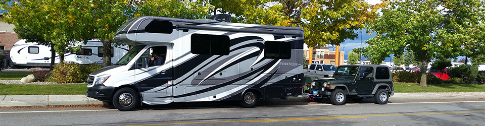
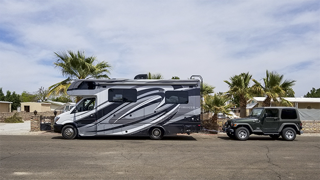
My RV is a Class C manufactured by Forest River and mounted on a Sprinter chassis. My tow is a 2016 Jeep Wrangler Sport.
Later I took Annie, my English Cocker, for a walk around the park, She did a lot of sniffing and pulled hard at the leash at one point because she wanted to walk out into the water that was lapping at the sandy beach.
After our walk, I spent way too much time on email and Facebook and computer chores. Finally, Annie and I unhooked my Jeep tow and went and went into town for a little bit of grocery shopping. Lake Havasu City has several groceries including Safeway, Albertsons and others. But my preferred grocery store in Lake Havasu City is Smiths. Smiths is one among several Kroger brands.
While shopping, I discovered that I should have bought my supply of wine and Tequila here at Smith’s rather than at fry’s (also a Kroger brand) in Yuma. Both are one to three dollars cheaper per bottle that what I pay in Montana. So why a supply to carry home? Cause it’s much less the price I pay in Washington State or Montana.
A loan figure enjoying the sunset at Lake Havasu State Park. He was joined by his partner a few minutes later.
As the sun started its journey toward the west, I once again took my camera and walked to the beach and took a few photos. I then walked back up to my rig and another guest suggested I take a photo of the bright moon lingering over city lights. That I did!
A bright moon hung over city lights at afternoon turned into evening as I finished my day’s activities and prepared for a good night’s sleep.I
This was the first This was the first day of a 18-day trip back to my home in Columbia Falls, MT. And the day was a good day to drive. There was a lot of preparation to be done before I could get on the road, but I finally was all packed and ready to go and left Yuma at 4:30 PM. This was a beautiful day and I enjoyed bright blue sky all the way, though I fought a wicked wind off the port bow for most of the drive.
The drive from Yuma, AZ to Lake Havasu City, AZ is along US 95 and is the shortest drive of my planned 18-day trip. The drive was only 152 miles and I arrived at my destination in less than three hours. But there is see along the way. I have seen most of it on past trips but thought I would share highlights here.
U.S. Army Yuma Proving Ground
My trip home to Montana began in Fortuna Foot Hills, a town of about 26,000 people on the outskirts of Yuma. I soon was northbound on US 95 and on my way. About 30 minutes into the drive I passed the entrance to United States Army Proving Grounds, which is easily recognizable due to the large sign saying so on the east side of the highway, and the large artillery pieces at the entrance on the west side of the highway with their barrels pointed high in the sky.
The Army Proving Ground is one of the largest military installations in the world and counts training and the testing of all kinds of military weapons as its major missions. Near the entrance is a small museum with several tanks, cannons and other artillery pieces placed around the grounds for visitors to see and touch. Each tank or artillery piece has an accompanying sign describing the equipment and when it was in service. (There also are signs cautioning visitors to be aware of possible rattlesnakes in the area).
Once past the Army Proving Ground, views are mostly of the Sonoran Desert. And the highway extends north straight as an arrow most of the way for several dozen miles. Frequent highway signs warn of wildlife. Other highway signs warn when a section of the highway is prone to flash floods. The flood prone places are marked by signage approaching a low spot in the highway where a channel has been carved in the desert by torrential rain storms. Those storms generally occur in late summer and early fall.
Quartzsite, Arizona Boondocking Capital of the World
About an hour and fifteen minutes into the drive I come to the intersection of US 95 and I-10 at Quartzsite, Arizona. Quartzsite is less than 20 miles east of the Colorado River and sports a population of less than 4,000 people but has become the RV boondocking capital of the world.
RVers come from all parts of the US and Canada for a variety of reasons. Some to escape winter weather in their home towns. Others come to enjoy camping in the desert environment, meet up with friends met in years past, attend a variety of events. Some RVers just like to hang out in the desert for a spell. This influx of RVers often swells the town’s population by several hundred thousand people in the winter.
One of the most popular events is the annual Quartzsite Sports, Vacation & RV Show. This show is held mid-to-late January and draws 750,000 to 1,000,000 attendees according to the Arizona Highway Department. More than a dozen other kinds of shows usually are listed on the Quartzsite Chamber of Commerce web site including such events as rock and garden shows, rock and gem shows and arts and crafts shows.
Parker and the Nellie E Saloon-Desert Bar
Thirty six miles north of Quartzsite is the town of Parker, Arizona. Parked is situated on the banks of Colorado River. The town has a population of about 3,000 people and is just 38 miles from Lake Havasu City, Arizona. Parker and communities along what’s called the Parker Strip are somewhat scenic and provide a relief from driving across the desert. Local attractions include a nearby golf course, marinas, the Bill Williams River National Wildlife Refuge, the Parker Dam, Buckskin State Park, River Island State Park, and a little farther north, the Cattail Cove State Park. Also, RV parks and resorts can be seen all along the river.
A popular and unusual nearby attraction is the Nellie E Salloon – Desert Bar. The Desert Bar is just 10 miles northeast of Parker and 38 miles south of Lake Havasu City, Arizona. To drive there, one exits US 95 at Cienega Springs Road. The junction of US 95 and Cienega Springs Road is about five miles northwest of Parker. Then it’s another five miles to the Desert Bar over a gravel road that is highly traveled when the bar is open. One see all kinds of Jeeps, SUVs, ATVs and everyday autos when driving the road.
Nellie E Saloon – The Desert Bar near Parker, Arizona
The bar is popular because it is unique in location, atmosphere and offers good music in an outdoor desert setting. The Desert Bar is situated on land that was an old mining camp and is a collection of all kinds of antique and eclectic buildings, furnishing, out buildings and related construction projects. Electricity if provided by solar panels. Visitors find good beer, food and good bands. The bands provide live music October through March. Other months are just too hot for the bar to be open. Reservations are not required, but the place often is crowded because it is open only on Saturdays and Sundays.
I visited the bar with friends a year before this trip and had a great time. The live music was a delight. The band from California produced great music which we enjoyed with our burgers and beer. I also picked up a t-shirt that is one of my favorites.
After passing the junction of Cienega Springs Road I continued north to Lake Havasu City, Arizona. The town was just a few miles ahead and I arrived at my reserved site at Lake Havasu State Park shortly after 5:00 PM. I quickly made camp, took a few photos and settled in for a restful night.
My family took this photo as I was about to leave Yuma to head home to Montana
Yuma to Lake Havasu City, Arizona was Day 1 of my five day-trip home.
This was my first year as a Snowbird. I spent most of the winter of 2017-2018 at Havasu Falls RV Resort in Lake Havasu City, Arizona. The city is a great place to stay anytime. There was something going on every weekend such as the Lighted Boat Parade at Christmas followed by a number of car shows, a balloon festival and a gathering of classic VW buses and bugs.
Friends and I enjoyed several hikes and also took in the Desert Bar near Parker, Arizona. We even saw a rattlesnake when hiking SARA Crack.
Then in March I moved down to Yuma to spend a few weeks with family at their winter home. And this was a particularly enjoyable family time. We took in museums, the annual air show at Marine Corps Air Station Yuma.
We also took time for exploring of the such as having lunch at Lake Martinez after driving a short distance through the Army’s Yuma Proving Ground. But now it was time to head home to Montana.
My route would be driving US 93 north through Nevada, Idaho and into Montana. I enjoyed driving on clear highways expect for light snow on Murry Summit near Ely, Nevada and crossing Lost Trail Pass at the Idaho and Montana border.
Before leaving Yuma I stopped at the Express Auto/RV Care at 12835 East 38th Street in Yuma (Fortuna Foothills) and had my RV washed at about noon. The cost was $66.00.
Afterwards, I filled my RV with diesel at Yuma Shell located at 11235 Fortuna Road in Yuma. I bought 13.548 gallons of diesel at $2.919 per gallon for a total of $39.55. I had driven 160 miles since my previous fill up in Lake Havasu City back on March 11 and got 11.8 miles per gallon on that tank.
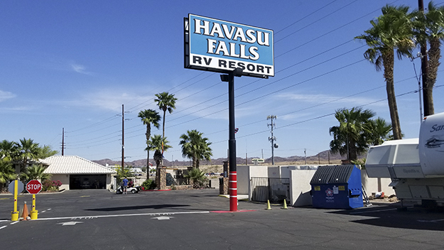
Havasu Falls RV Resort is where I spent my first Snowbird winter and now I’m stopping here again for a couple of nights on my way to Montana.
And then I was on my way from Yuma to Lake Havasu City, Arizona for a couple of nights. I arrived at Havasu Falls RV Park located at 3493 Highway 95 North at 4:25 PM. I checked in and paid $109.78 for two nights.
GPS lead me astray on a recent trip to the Phoenix area from Lake Havasu City. I was driving MY RV to Phoenix to attend an event which interested me. My intended route was to drop south on AZ Highway 95 to Quartzsite where I would pick up US 10 and follow it east to Phoenix.
My destination was the Pioneer RV Resort located just off I-17 a few miles north of the Phoenix city limits. But that’s not the route I took.
Instead, I logged onto my smartphone GPS navigation app and also onto the RV’s GPS Navigation system. In both instances I typed in the street address of the RV park. Both GPS systems showed identical routes to my destination. “Ah!” I thought, “All is well and good”. Little did I know what was to unfold.
The route mapped out by the two GPS systems was not the route I had planned, and which I described above. The new route took me north on AZ highway 95 to I-40 and the town of Kingman. Then, about 20 miles east of Kingman I exited I-40 and followed US 93 to the little town of Wikieup. There, I filled up with diesel fuel and filled my propane tank. My RV took 13.651 gallons of diesel fuel at $3.099 per gallon and my propane tank took 2.69 gallons of propane at $2.29 per gallon.
Bank on the road again, I continued south on US 93 to Wickenburg where I went through a roundabout (Arizona really likes roudabouts) that put me on US 60. I followed US 60 south to the intersection with SR 74, which was about 12 miles northwest of Morristown. So far, so good. But that was about to change.
SR 74 is a nice highway and I followed it, per my GPS’s, to the intersection of New River Road. And that’s where things went bad. Now I’m driving northeast instead of southeast. I followed New River Road to a point on the road where both GPS’s said was my destination. But, there was no RV park at this location.
Bewildered, I drove up the road maybe a quarter of a mile and turned into West Arroyo Norte Drive. I soon realized I was in what appeared to be a residential neighborhood. Now, the night is pitch black dark and I have no idea where I am. So, I made a U turn and went back to New River Road and retraced by path back to the point where the GPSs told me was the RV park.
At this point I’m more confused than ever. So I called a friend that lives in Tempe and asked her to log on to her computer and bring up Google Maps. I also gave her the street names of New River Road and West Arroyo Norte Drive hoping she could tell me where I was in relation to Pioneer RV Resort. She gave it a go and said maybe I was on the wrong side of I-17.
Now, it’s dark and I have no idea where I am. But I retrace my path on New River Road and head back south to where it crosses I-17 and followed what I think was a frontage road to a business area called the Outlets at Anthem. There I found a street that I thought might lead me to the RV park. I should not have tried it.
That street (which I may have thought was a frontage road) was a dead end. .The road was narrow. It’s very dark outside. But I follow the road to the absolute. I’m thinking there may be enough room at the end so that I can make a U turn. No such luck.
As I feared, now I must unhitch my Jeep. Turn it around and move the Jeep out of the way. My next challenge is to turn the RV around, which I did by making short moves in reverse, then forward, then in reverse again and after such maneuvering I finally got it turned around.
Now, it was just a matter of hitching up the Jeep and on the road again. I still do not where the RV park is located. After driving a few hundred yards I come up to a couple of pickup trucks at a dirt intersection and ask the driver of one if he knew where I might find Pioneer RV Resort. He pulled out his smartphone, searched on the park’s name and soon showed me on the phone’s map app where I was and also the location of the park.
I did the same search on my phone and was soon on my way to the park, which was about five miles south of my current location.
Lessons Learned
1. Study a paper map, or, Google Maps on your smartphone or computer before heading out.
2. You might have better luck on your GPS search by putting in a business name rather than a street address.
Lake Havasu City now is just a day’s drive from Barstow. I’m out of bed and outside walking Annie shortly after 6:00 AM and taking a few photos of the park. Looking around a bit, I see that Shady Lane RV Camp is nicer than I first thought upon my arrival in the dark last night. Also, I’ve discovered that comments pasted to an online site about the park are highly favorable. And I agree. The staff, in particular, are tops!
After breakfast it’s time to hit the road. Google Maps states the drive is 181 miles and should take 2 hours and 42 minutes. We’ll see! Still, that should be a relaxing drive compared to yesterday’s 7-hour drive of from Chowchilla, California to Barstow California.
I unhook electrical, water and sewer lines, stow gear and make the interior ready for the road. I pull out and drive out the exit. Now that I’m back on a local road I realize I’m not sure how to get on the Interstate. So I pull out the map that was given to me during registration. And wow! I’m totally confused.
There is way too much information on the map. I suspect the map was made to show many alternatives such as how to get to the center of town, or, take a variety of highways depending on one’s destination. I exit Shady RV park and turn right on Soapmine Road and take what I think is the direction to I-40. However, I turned left on Old Hwy 58 instead of right. That takes me into a residential area where I search for a spot where I can turn around without unhitching my Jeep. Totally frustrated, discard the map and revert to my smartphone’s map and finally I’m on the right highway. Thus, I reverse direction and head east on Old Hwy 58 and find the on ramp to I’15.
Now driving westbound on I-15 I’m discovering that finding my way onto I-40 is more of a nightmare than getting from the RV park to I-15. Again, I use my trusty smartphone’s map to show the way. The way is to drive westbound on I-15 and take the Exit 184 which puts you on “E Main Street”. Turn left on E Main Street and follow it south under I-40, and follow the signs to the right to on ramp to the I-40 East and the Needles Freeway. Good luck!
Lake Havasu City is Not Far Away
By 10:55 I’m driving southeast on I-40 toward Needles, California and on to Lake Havasu City. To my left are the Mojave River and the Burlington Northern Santa Fe Railroad tracks. And to my right is the Marine Corps Logistics Base Barstow. The base is the second largest employer in the Barstow area and its mission is primarily to serve the United States Marine Corps as a supply and maintenance installation.
An hour later and I’m definitely feeling like I’m driving in desert country. There is not a tree in sight in any direction and I haven’t seen one for quite awhile. I suspect this is the kind of scenery I’ll be seeing all the way to Lake Havasu City. Also, the motorcyclist up ahead are the first I’ve seen this entire trip.
1:23 PM: I stopped at the Shell station located at 2451 W. Broadway in Needles, CA to buy diesel fuel. I bought 16.711 gallons at $4.099 per gallon for a total of $68.50. I had driven 283 miles since my last fill up and had gotten 16.9 miles per gallon on that drive. I’m really getting close to my winter home now.
Soon Crossing the Colorado River, the divide between California and Arizona
About an hour later, at 2:40 PM I’m about to cross the Colorado River and soon will be in Arizona. A sign I saw 10 minutes ago said it was just 20 miles to the exit at State Route 95 that will take me to Lake Havasu City, Arizona.
I’ve crossed the border into Arizona and there’s my exit up ahead. I’ll make a right turn onto State Route 95 and soon I will be at my destination.
Arriving at Lake Havasu City
At almost 4:30 PM I’ve arrived at my destination for the winter, Havasu Falls RV Resort. I quickly check in and then drive to my designated site and hook up my electricity, water and sewer connections. I also let Annie out and take her for a walk around the RV park and let her do her business. I’m excited to be here, but on the other hand I find the scenery a bit dull. Everything is brown including the mountains. So different from the green mountains of Montana. I’ll get use to it soon, but it will be days before I see a single blade of green grass and that was in the lawn at the courthouse.


 GPS lead me astray on a recent trip to the Phoenix area from Lake Havasu City. I was driving MY RV to Phoenix to attend an event which interested me. My intended route was to drop south on AZ Highway 95 to Quartzsite where I would pick up US 10 and follow it east to Phoenix.


